Let’s talk trees and trout streams Part 1: Southeast Minnesota


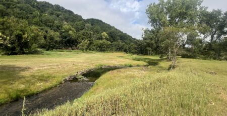
A box elder sitting on top of legacy sediment, ready to fall in and take a big chunk of the bank along with it! Mill Creek, Chatfield (Winona County).
By Dr. Jennifer Biederman
The Driftless Area of southeastern Minnesota, characterized by its unique topography of steep hills and deep valleys untouched by the last major glacial movement, experienced significant changes when European settlers began clearing and deforesting the land for farming during the 19th and early 20th centuries. The production was intense – in fact, by the mid-late 1800’s, the Winona area was the 2nd leading grain producer in the entire U.S.
Although this was great for the economy, it didn’t take long for this land use to take its toll on the landscape, including watersheds. Once crystal clear, cold spring-fed streams ubiquitous across the southeastern corner of the state became laden with what are referred to as “legacy sediments.” Legacy sediments in the Driftless Area refer to the accumulated sediments that were deposited because of these historical land use practices. Without the protective cover of forests and native vegetation, the region’s soil became highly susceptible to erosion. Heavy rains would wash soil from the uplands into the valleys and stream channels, leading to the build-up of large amounts of sediment along riverbanks and floodplains.
Legacy sediments – often three to more than ten feet in depth – trap streams by accumulating in the riverbeds and valleys, effectively raising the floodplain (and streambanks) above its natural level. When streams become buried under these sediments, several significant changes can occur:
- Stream Entrapment and Channel Narrowing and Downcutting. As legacy sediments accumulate, they can trap streams in a narrower channel, reducing the natural meandering of the watercourse. This confinement forces the stream to flow in a more restricted path, increasing the water’s velocity and erosive power. During heavy rainfalls and high flow events, the stream cannot access the floodplain, where energy would otherwise be dissipated. Instead, the energy of the heavy flows is trapped within the steep banks, causing vertical erosion of the streambed as the water cuts through the accumulated sediments to reach a more stable base level. This process can significantly down cut the channel over time.
- Disconnected Floodplains: As the floodplain elevation rises and stream channel cuts downward, it becomes further incised or entrenched, further disconnecting it from its historical floodplain and creating steep banks, which typically lack deep rooted vegetation and are susceptible to erosion. This separation occurs because the stream now flows at a much lower level compared to the surrounding landscape. Floodplains, which used to receive regular overflows, are now perched above the channel, preventing floodwaters (and flood energy) from spreading out and depositing nutrients during high-flow events.
- Hydrological and Ecological Impacts: The disconnection of streams from their floodplains disrupts the natural hydrological processes and aquatic habitats. Floodplains serve as critical areas for groundwater recharge, sediment deposition, and nutrient cycling. Their disconnection can lead to diminished water quality, reduced habitat complexity, and loss of biodiversity. Additionally, the altered stream dynamics can exacerbate erosion and sedimentation downstream.
So, what do legacy sediments have to do with trees?
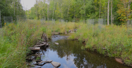
Over the last 150 years, stream corridors and valley hillsides within the agricultural landscape were deforested and eroding soils buried stream valley floors in “legacy” sediments. As agricultural and land use practices changed over time, many riparian corridors, now filled with legacy sediments, started to “reset” with the succession of vegetation, with grasses giving way to shrubs and eventually trees, like box elder and invasive black locust. These now perch on the edges of tall eroding streambanks along many streams in southeast Minnesota. Unfortunately, these are short lived, shallow-rooted trees that do a poor job of stabilizing streambanks. MNTU habitat restoration work seeks to restore ecological function of the stream by reconnecting the floodplain through removing deep legacy sediments, grading back streambanks and creating a more natural pattern of meanders to the stream channel. This cannot be accomplished unless the trees now growing in these legacy sediments, including box elder, black locust, honeysuckle, and buckthorn, are removed and replaced with native, deeply rooted forbs and grasses that stabilize the shoreline while offering important habitat for wildlife including birds and insects.
What happens if there are “high quality” hardwood trees within a stream restoration corridor?
Often, mixed in with the less desirable species, are desirable, long-lived species of hardwoods which offer wildlife habitat, shade, and a source of woody material for the stream. Whenever possible, we seek to protect and preserve these trees in the project design.
Don’t we need shade to cool the streams?
Streams in southeast Minnesota are fed with an abundance of groundwater springs, which keep the stream cold in the summer and “warm” or free of ice in the winter. Recent (within the last 5-10 years) water temperature monitoring has not shown any immediate threats to water temperatures suitable for trout in southeast MN trout streams. And in fact, Vaughn Snook (Fisheries Biologist) at the DNR Lanesboro Fisheries office has been collecting water temperature data for the past ten years in streams across southeast Minnesota. In this time, streams with appropriate summer water temperatures (cold!) have even been added to a new trout stream designation proposal.


